The area of disturbed weather we’ve been tracking is now Potential Tropical Cyclone #1.
AccuWeather forecasts a rainstorm will strengthen into Tropical Storm Arthur, becoming the first of the Atlantic Hurricane season.
The potential for life-threatening flooding should have the attention of tens of millions near the Gulf Coast and across the Southeast United State as heavy rain will continue throughout the week, enhanced by what could be the first tropical storm of the year. The first name on the list is Arthur.
“Some parts of Texas and Louisiana have already received 4-6 inches of rain since Sunday. The additional downpours from the tropical rainstorm will pose a serious risk for major flooding that could quickly turn life-threatening,” said AccuWeather Vice President of Forecasting Operations, Dan DePodwin.
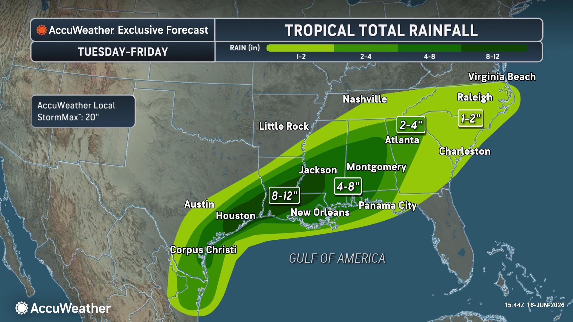
AccuWeather forecasts 8-12 inches of rain to fall around Houston and an area stretching from the eastern Texas coastline, across Louisiana and into central Mississippi. New Orleans is on the edge of the heaviest rain but can still experience torrential rain rates of 2- 4 inches per hour which can quickly lead to life-threatening flooding.
In addition to the flooding threat from rain, coastal flooding and inundation can occur, especially as the storm moves inland Wednesday night. There could be minor storm surge along the immediate Texas and Louisiana coast.
“Although the storm is forecast to make landfall Wednesday night near the Texas/Louisiana border, a high risk to lives and property exists through at least Thursday from Texas to Mississippi. The flooding risk will continue well past landfall as the moisture from the storm slowly moves east across the Southeast U.S.,” DePodwin added.
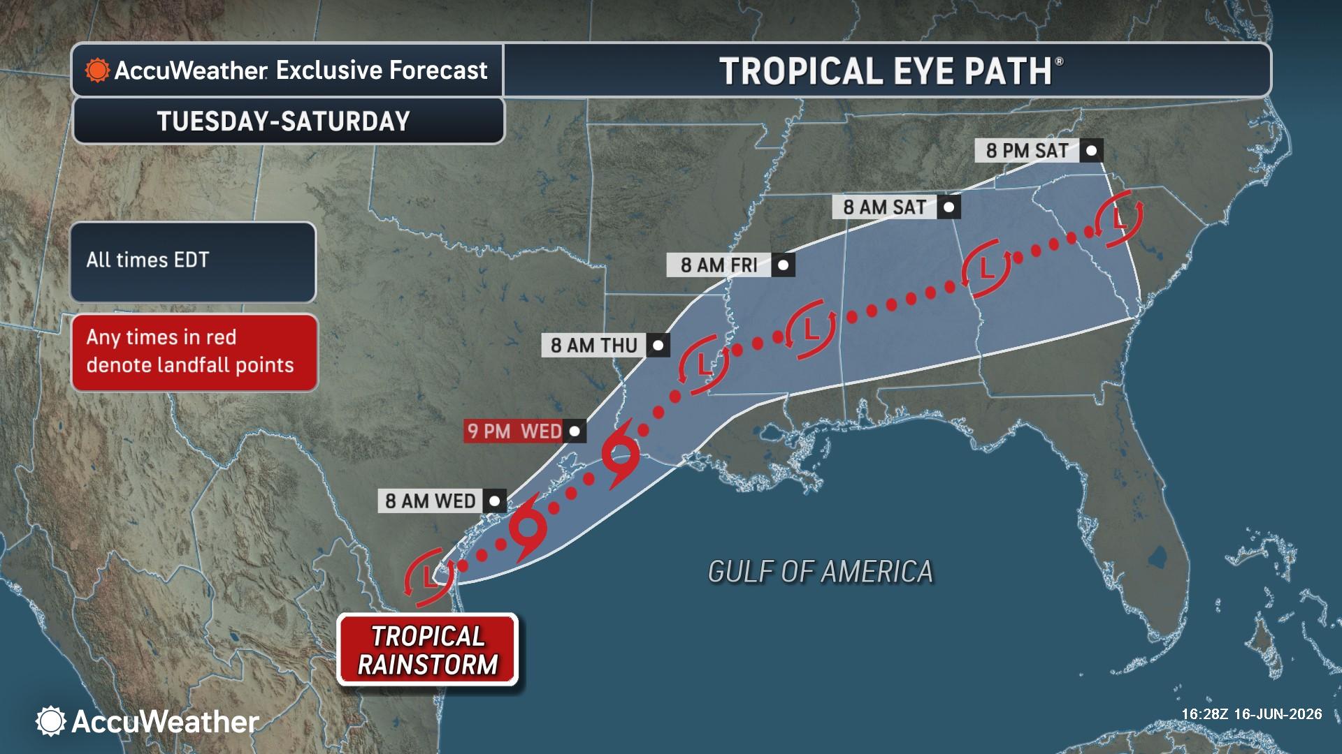
Significant rain is expected to last through Friday with the zone of greatest risk slowly shifting eastward from Texas Tuesday to Georgia by Friday.
- AccuWeather is forecasting 8-12 inches of rain from Wednesday through Friday in Houston and southwest Louisiana with more widespread rainfall totals of 2-4 inches can occur from coastal Texas extending into the Southeast
- Locally higher amounts of 4-8 inches are possible for portions of southeastern Texas through central Alabama
- The AccuWeather Local StormMax™ rainfall amount is 20-inches across portions of the region.
Sources:
AccuWeather
The post by Donna Thomas, Meteorologist appears on South Florida Reporter.
VIP Journal Media