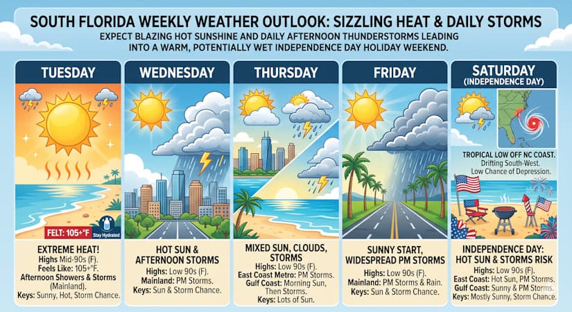
Expect blazing hot sunshine and daily afternoon thunderstorms leading into a warm, potentially wet Independence Day holiday weekend.
Tuesday features lots of sizzling hot sun and some afternoon showers and storms on the mainland. The Keys will be sunny and hot, with a chance of showers or storms in spots. Tuesday’s highs will be in the mid 90s on the mainland and mostly in the low 90s in the Keys — but it will feel about 10 degrees hotter everywhere, so stay hydrated and out of the sun.
Wednesday will bring hot sun and mainly afternoon storms to the mainland. The Keys will see lots of sun and maybe a shower or storm. Wednesday’s highs will be in the low 90s on the mainland and near 90 degrees in the Keys.
Thursday will feature a mix of sun, clouds, and afternoon storms in the East Coast metro area. The Gulf Coast will see plenty of sun, morning showers, and afternoon storms. Look for lots of sun in the Keys. Thursday’s highs will be in the low 90s in the East Coast metro area and near 90 degrees along the Gulf Coast and in the Keys.
Friday will be sunny in the morning on the mainland, but look for periods of showers and storms in the afternoon. The Keys will see sunny skies, with a chance of showers or storms in spots. Friday’s highs will be in the low 90s on the mainland and near 90 degrees in the Keys.
The Independence Day forecast calls for hot sun, some clouds, and periods of showers and storms in the East Coast metro area. The Gulf Coast will see sunny skies and periods of showers and storms. The Keys will be mostly sunny, with a chance of showers or storms. Highs on Saturday will be mostly in the low 90s.
In the tropics, a low forming off the North Carolina coast has a low chance of becoming a depression as it drifts southward and then westward during the next several days.
The post by Donna Thomas, Meteorologist appears on South Florida Reporter.
Tags
VIP Journal Media