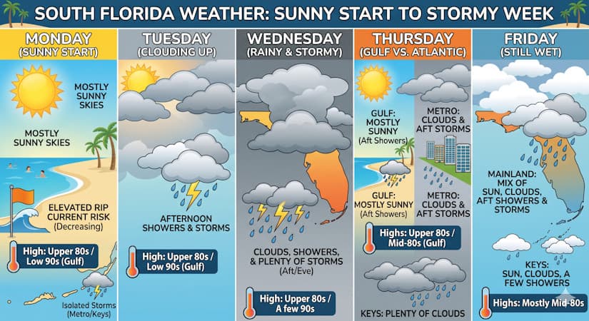
Monday brings mostly sunny skies and warm temperatures, but expect increasing clouds, afternoon showers, and storms starting Tuesday.
Monday features mostly sunny skies around South Florida, with the chance of a storm or two in the East Coast metro area and the Keys. Expect an elevated but decreasing risk of dangerous rip currents at the Atlantic beaches. Monday’s highs will be mostly in the upper 80s in the East Coast metro area and the Keys, and in the low 90s along the Gulf Coast.
Tuesday will bring more clouds than sun with some mainly afternoon showers and storms. Tuesday’s highs will be in the upper 80s in the East Coast metro area and the Keys, and in the low 90s along the Gulf Coast.
Wednesday will feature clouds, showers, and plenty of storms lasting from the afternoon into the evening. Wednesday’s highs will be mostly in the upper 80s, with a few mainland locations reaching 90 degrees.
Thursday will see more clouds than sun and afternoon showers and storms in the East Coast metro area. The Gulf Coast will be mostly sunny with periods of showers and storms in the afternoon. Look for plenty of clouds and some showers in the Keys. Thursday’s highs will be in the upper 80s in the East Coast metro area and the Keys, and mostly in the mid-80s along the Gulf Coast.
Friday’s forecast calls for a mix of sun, clouds, and plenty of afternoon showers and storms on the mainland, while the Keys will see sun, clouds, and a few showers. Highs on Friday will be mostly in the mid 80s.
The post by Donna Thomas, Meteorologist appears on South Florida Reporter.
Tags
VIP Journal Media