
We’re still in the early innings of a wet and unsettled weather pattern. Here’s evidence of the rainy conditions (from Tuesday), These high rain tallies...
We’re still in the early innings of a wet and unsettled weather pattern. Here’s evidence of the rainy conditions (from Tuesday),
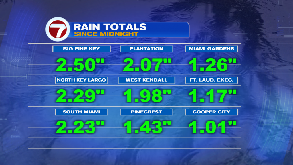
These high rain tallies prompted a concern for street Flooding, in spots. During the mid-afternoon (Tuesday) a Flood Advisory was issued for the Lower Florida Keys. The flood threat will likely “build back” for favored locations on Wednesday. As such, the National Weather Service has EXTENDED a Flood Watch for coastal and metro areas (both Miami-Dade and Broward counties).
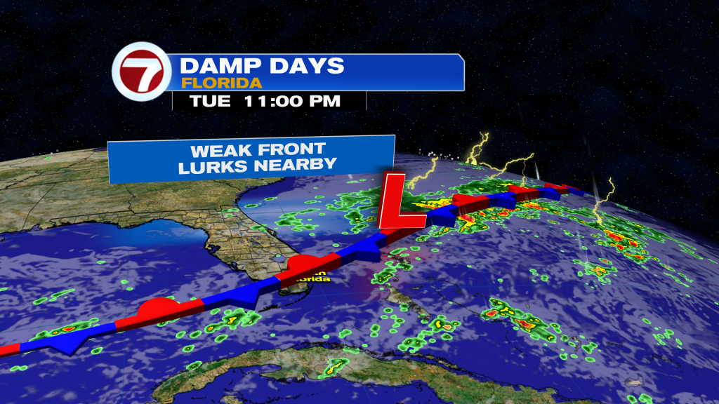
The reason for the continued soggy conditions involves a lingering boundary (shown above), which is now a Stationary Front over the region.
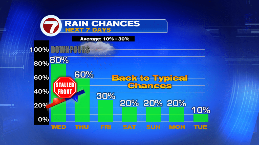
Rain Chances will remain quite high, through Thursday. After that? Showers will be less frequent as the Front and a moisture shield starts to break up. It’s worth noting that just we get a “rain reduction” we’ll also see a increase in winds off the ocean. The upcoming weekend is shaping up to be a Gusty one, although with pleasant temperatures.
Etiquetas
VIP Journal Media


