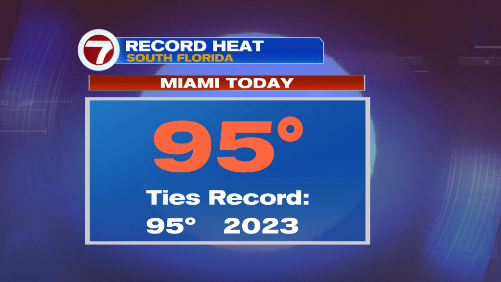
We’ve all been feeling the strong heat in recent days. On Tuesday, the high soared to 95-degrees in Miami and enough for the record books...
We’ve all been feeling the strong heat in recent days. On Tuesday, the high soared to 95-degrees in Miami and enough for the record books (tying the record high)! Most of Miami-Dade and Broward County was also under a Heat Advisory much of the day (expiring at 6 pm).
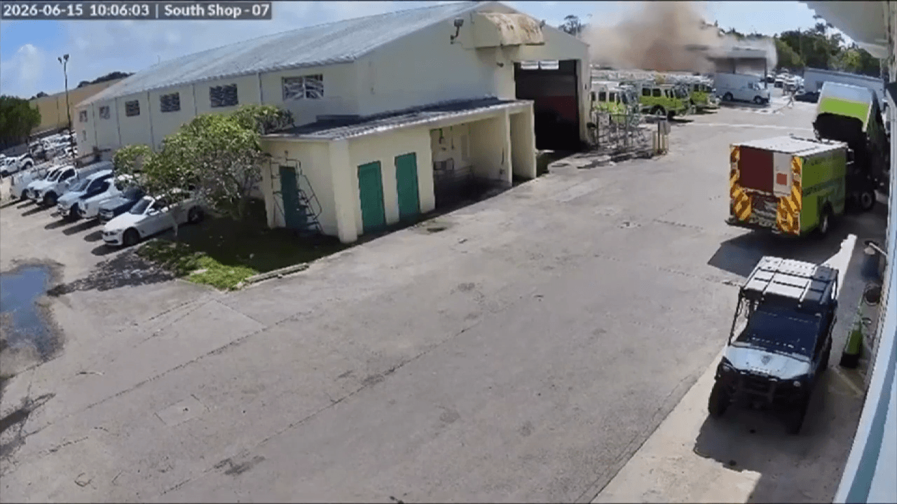
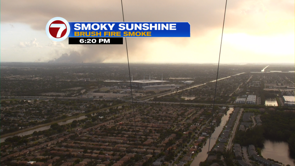
Along with the heat and humidity has been an abundance of Smoke. It’s derived from a large Brush Fire (in western Miami-Dade) with far-reaching impacts on air quality. Alerts may be necessary, at times, as improvement won’t come fast enough. Part of the problem is that winds are pushing the smoke plume north and northeast. Therefore, smoky impacts are spreading directly into Broward County while the smell of smoke is evident virtually everywhere north of the actual fire.
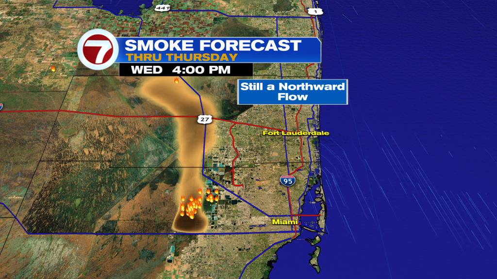
Looking ahead to Wednesday, it’s a similar situation with hot and smoky conditions, along with a light breeze. With the southerly flow intact, the smoke will shift north (as seen in the graphic below).
Here’s a “weather map view” and what’s prompting our sticky situation.
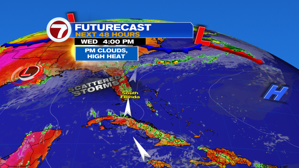
High Pressure is “directing the show” as it persists over the western Atlantic. The High will tend to get a little stronger from Wednesday night into Thursday. That will do us a few favors, including a better breeze (southeast) and a Drier shift.
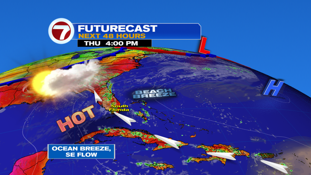
In fact, Thursday is forecast to be the driest day of the stretch. However, in the 7-day rain forecast (below) you can see a retreat higher. Chances will soon be back to Typical for this time of year.
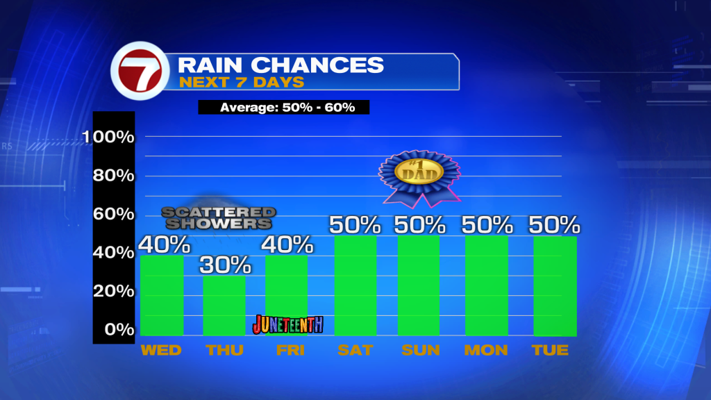
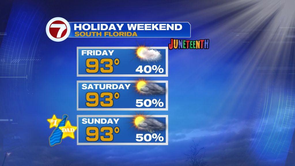
As we enter the home stretch of the week, we have the arrival of important Holidays. After Juneteenth, Friday, the weekend goal will be to “keep Dad cool” as heat lingers into Father’s Day, Sunday.
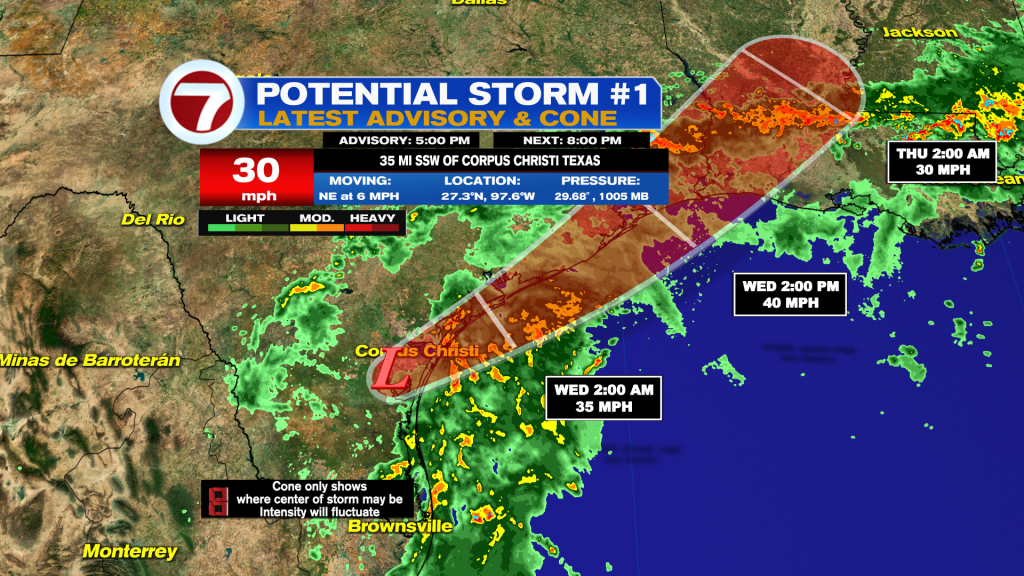
Finally, we’re keeping a watch on the Tropics and what could be the first tropical storm of the 2026 Atlantic season. The National Hurricane Center has dubbed a disturbance, over south Texas, Potential Storm #1. As of this writing, it’s simply a disorganized weather feature about to skirt the Texas coastline. Depending on the track (and access to nearby water) we may see a strengthening spin that brings increased wind and rain to the Gulf coast. While not yet classified as a tropical system, there’s a forecast track and updates from the NHC. All told, the system is likely to move back over land late Wednesday, so any depression or storm would be brief. Heavy flooding rains, though, could cause major issues for the region.
Etiquetas
VIP Journal Media