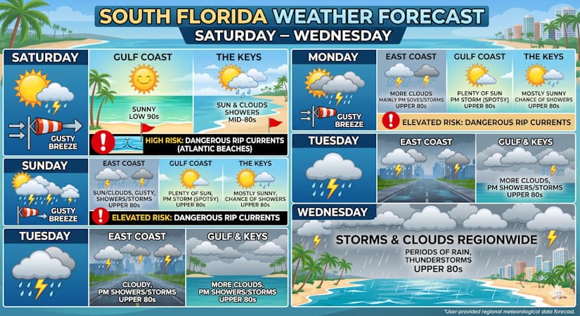
Sun and gusty breezes kick off the weekend before cloud cover and widespread afternoon thunderstorms roll in by midweek.
Saturday
- East Coast Metro Area: Mostly sunny skies with a chance of a shower or storm on a gusty breeze. Highs in the mid-80s.
- Gulf Coast: Sunny skies with highs in the low 90s.
- The Keys: A mix of sun, clouds, and some showers. Highs in the mid-80s.
- Marine Alert: A high risk of dangerous rip currents is in place at all Atlantic beaches.
Sunday
- East Coast Metro Area: A mix of sun and clouds, a gusty breeze, and periods of showers and storms. Highs in the upper 80s.
- Gulf Coast: Plenty of sun with an afternoon storm possible in spots. Highs in the upper 80s.
- The Keys: Mostly sunny skies with the chance of a shower or two. Highs in the upper 80s.
- Marine Alert: Expect an elevated risk of dangerous rip currents at all Atlantic beaches.
Monday
- East Coast Metro Area: More clouds than sun, with mainly afternoon showers and storms. Highs in the upper 80s.
- Gulf Coast: Mostly sunny with some afternoon storms developing in spots. Highs in the upper 80s.
- The Keys: Mostly sunny with a lingering chance of showers or storms. Highs in the upper 80s.
Tuesday
- East Coast Metro Area: Cloudy skies with afternoon showers and storms. Highs in the upper 80s.
- Gulf Coast & The Keys: More clouds than sun, with afternoon showers and storms moving through. Highs mostly in the upper 80s.
Wednesday
- South Florida Regional Forecast: Overcast conditions dominate with widespread clouds, showers, and storms around the entire region. Highs will remain in the upper 80s.
The post by Donna Thomas, Meteorologist appears on South Florida Reporter.
Etiquetas
VIP Journal Media
¿Necesita Servicios de Medios Premium?
Diseño Web
Identidad de Marca
Producción Impresa
Explorar Nuestros ServiciosLa confianza de las marcas líderes del Sur de Florida