
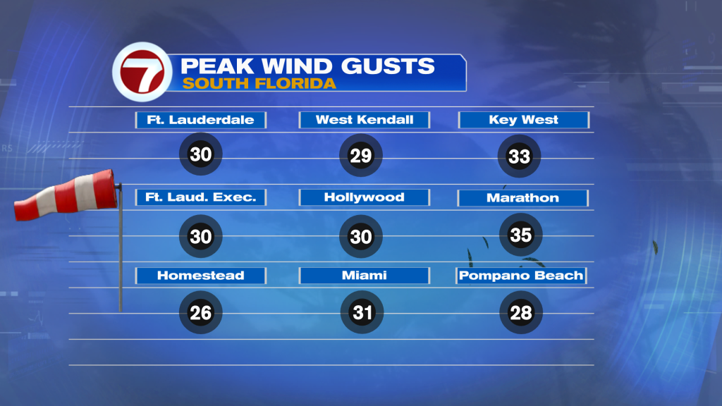
Our windy weather pattern has finally peaked. On Monday, winds cranked (yet again) with gusts that peaked around 30 miles per hour. Here’s a breakdown...
Our windy weather pattern has finally peaked. On Monday, winds cranked (yet again) with gusts that peaked around 30 miles per hour. Here’s a breakdown with the strongest wind reports occurring across the Florida Keys.
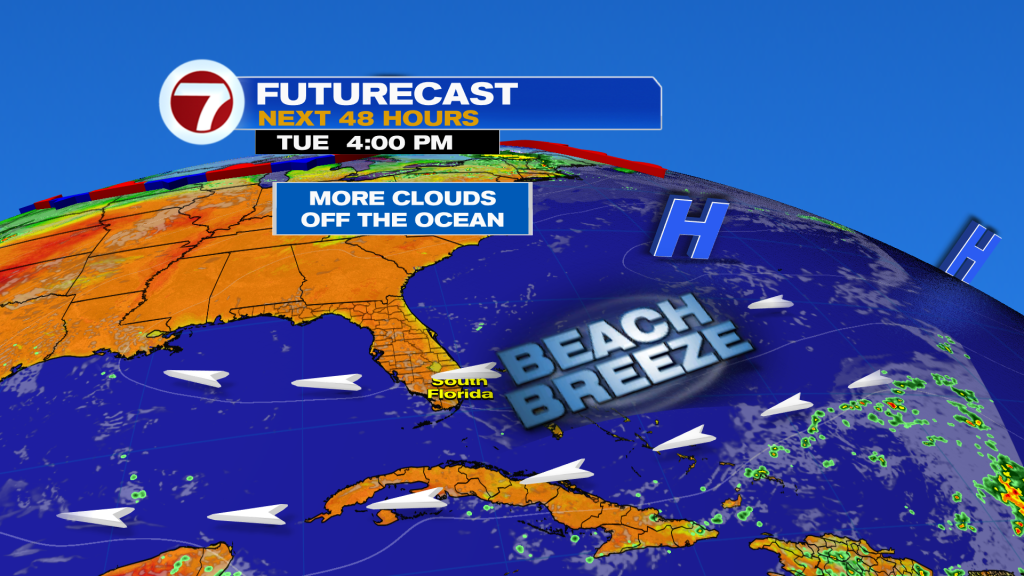
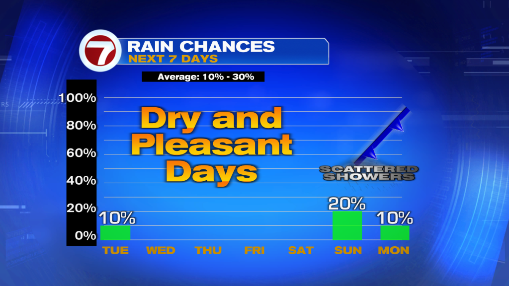
These winds are forecast to taper off (becoming less intense) as we get into the middle of the week. What won’t change is the direction of the flow arriving off the Atlantic. Marine and beach hazards should continue longer with the greatest threat being Rip Currents. Besides that? The Florida weather pattern looks benign. Check out this “uneventful” satellite / radar view, shown below.
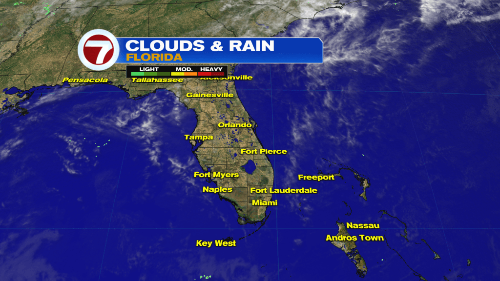
Moisture levels are low and most places will stay dry across the region. On the weather maps (there are two of them, below) we see what’s in command of the overall pattern. Even though it’s not directly over us, yet, it’s a large and extensive area of High Pressure.
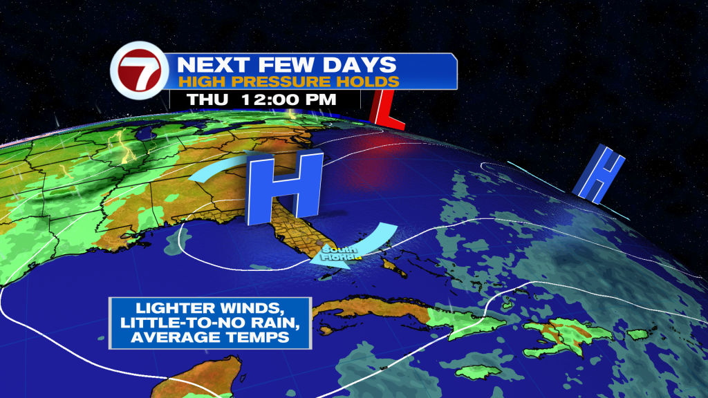
By Thursday, the High Pressure wedge will expand westward, while weakening. That will keep us well-separated from areas of rain. In fact, the main moisture bands will tend to hover well north, south, and east of our area. Could this hold the rest of the week? It does appear that way. The next weather change doesn’t take place until we get into the second half of the upcoming weekend. At that time, High Pressure will fade away (getting shunted south) with the approach of a Front. This Front should reach us early next week yet it’s too early to get a handle on details. I will say, though, there may be a small “degree” of cooling with nighttime lows coming down between 5 – 10 degrees by the middle of next week.
Теги
VIP Journal Media


