
It was a true “heat repeat” on Tuesday. Miami made it into the record books (just as we did on Monday) with highs reaching the...
It was a true “heat repeat” on Tuesday. Miami made it into the record books (just as we did on Monday) with highs reaching the mid 90’s. That exceeded the previous record for the date. Meanwhile, Key West hit 91-degrees which tied the record high for the Lower Keys.
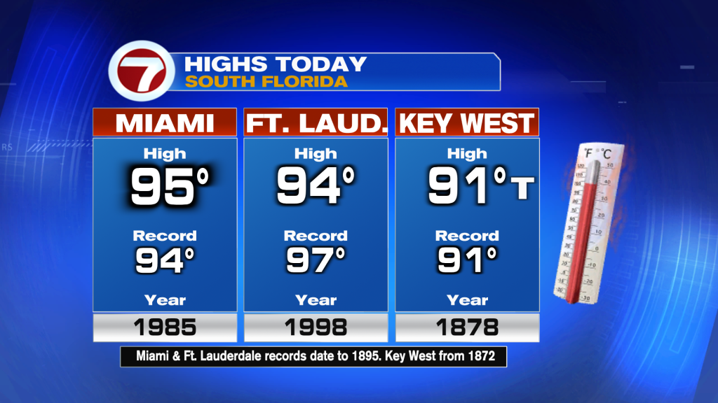
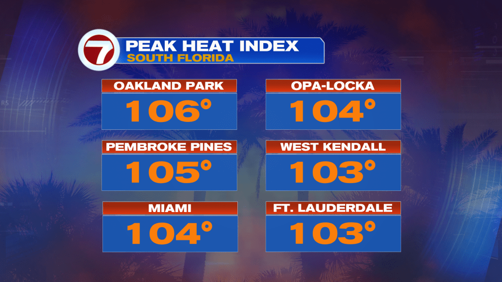
Without doubt, it’s been a sizzling start to June, since our average highs are typically in the upper 80’s. Beyond the actual air temperatures, the Heat Index (with humidity factored in) showed values in the triple digits during Tuesday afternoon.
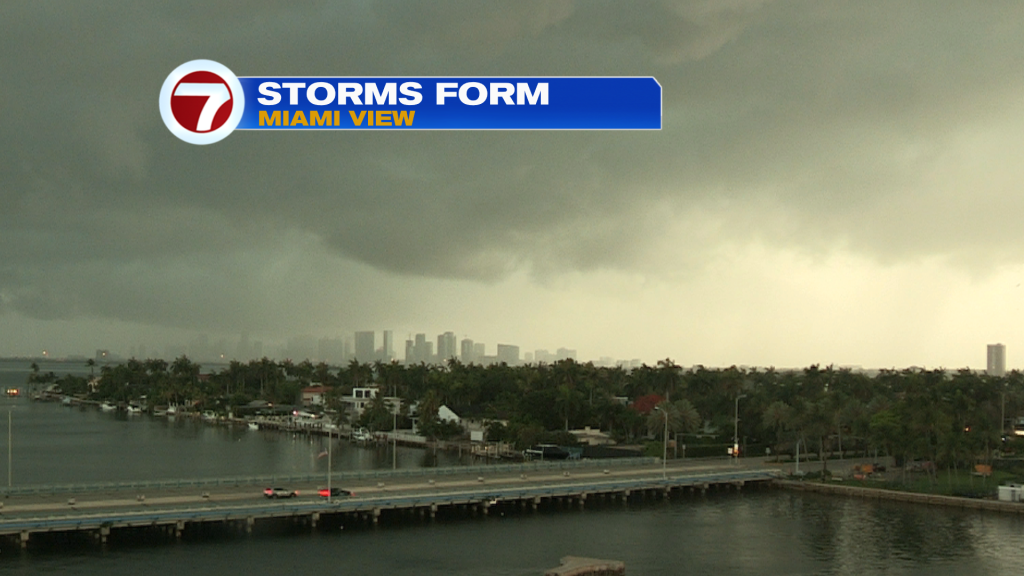
Shortly after the steamy conditions peaked, storm clouds were spreading in from the south and west.
Heading into Wednesday, you’ll detect some differences. Instead of the “sun to storms pattern” we’ll have earlier cloud cover with scattered showers. That’s likely to limit the overall heating so forecast highs will be closer to average (upper 80’s). The other change will include a southward moving Front that’s set to bring unsettled conditions.
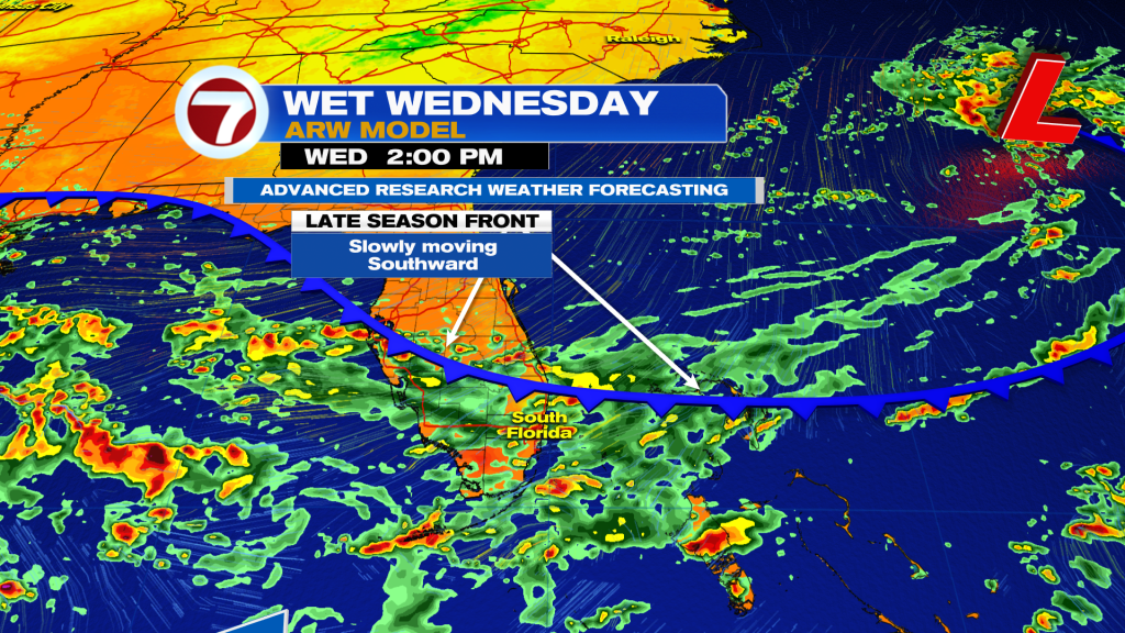
We’re also likely to get more familiar with this arriving Front. It is forecast to stall out “nearby” as we continue through the week.
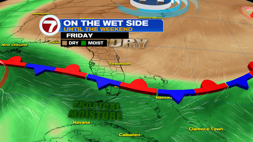
The combination of the lagging, late season front plus ample moisture from the tropics will lead to (more) periods of rain and storms. High rain chances will hold through Friday, at least. Depending on the holding power of the Front, we may need to wait for better drying conditions into early next week. Stay tuned.
Теги
VIP Journal Media


