
It’s been a while since we’ve had an unsettled weekend with better opportunities for rain but that’s in store for the final day of February...
It’s been a while since we’ve had an unsettled weekend with better opportunities for rain but that’s in store for the final day of February and first day of March. It won’t be a weekend washout though with a decent amount of dry time expected, especially in the morning hours.
The main culprit is a weakening front sliding south across Florida, drawing in more moisture and therefore higher chances for rain.
At the very beginning of the weekend, Saturday morning will be warm and humid with fog possible, which could be dense inland.
Then during the day Saturday, temperatures will quickly climb into the mid 80s for most given all the sunshine. It’s not until the mid to late afternoon hours when rain chances will be elevated, meaning scattered showers and storms will be possible.
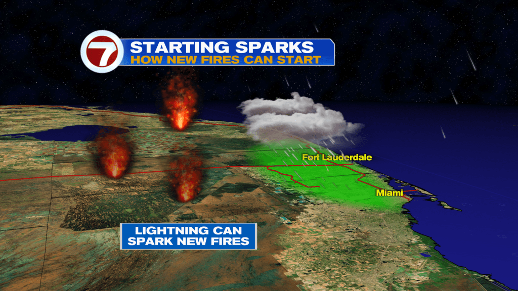
Given the dry grounds and the potential for thunderstorms, any lightning strikes could actually spark additional brush fires, especially in the Everglades.
Then come Sunday, it will be a fairly similar story. Despite the front having crossed early in the day while the breeze builds out of the northeast, scattered to potentially numerous showers and downpours are expected, especially in Miami-Dade based off the current model guidance.
While this won’t be a drought-busting rain, any little bit could help with isolated 1+ inch totals possible.
Heading into next week, a dome of high pressure builds overhead, keeping temperatures warm and humidity levels somewhat high.
A bit of low-level moisture will get blown onshore with a persistent, easterly breeze, however, so occasional passing showers can be expected next week.
Теги
VIP Journal Media


