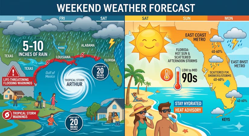
Tropical Storm Arthur triggers severe flooding out west while Florida stays mainly hot with typical scattered summer afternoon storms.
Thursday features hot sun and a few clouds, as well as an early storm in spots along the Gulf Coast and a few afternoon showers and storms in the East Coast metro area. The Keys will see lots of hot sun. Thursday’s highs will be in the low 90s right at the coasts and in the mid 90s elsewhere on the mainland, and the Keys will top out near the 90-degree mark. But it will feel even hotter, so stay hydrated and out of the sun.
Juneteenth will bring a mix of hot sun, clouds, and mainly afternoon showers and storms to the East Coast metro area. The Gulf Coast and the Keys will be sunny and hot. Friday’s highs will be in the low 90s in the East Coast metro area and near 90 degrees along the Gulf Coast and in the Keys.
Saturday will feature lots of hot sun and plenty of afternoon showers and storms in the East Coast metro area. The Gulf Coast will be sunny with periods of showers and storms. The Keys will see lots of hot sun again. Saturday’s highs will be in the low 90s in the East Coast metro area and mostly in the upper 80s along the Gulf Coast and in the Keys.
Sunday will be mostly sunny, with mainly afternoon showers and storms in the East Coast metro area. The Gulf Coast will be sunny with some afternoon showers and storms. Look for lots of sun in the Keys. Sunday’s highs will be in the low 90s in the East Coast metro area and near 90 degrees along the Gulf Coast and in the Keys.
Monday’s forecast calls for a mix of hot sun, clouds, and periods of showers and storms in the East Coast metro area. The Gulf Coast will see lots of sun with periods of showers and storms, while the Keys will be sunny and hot. Highs on Monday will be mostly in the low 90s.
As we watch what is now Tropical Storm Arthur in the Gulf of Mexico, we’re seeing once again that even a weak tropical storm can have very serious consequences. Arthur is already causing life-threatening flooding in Texas, and the flooding will spread throughout the region. While Arthur’s maximum sustained winds were 45 miles per hour early Wednesday evening, its real threat is the 5 to 10 inches of rain (with some locations receiving as much as 20 inches) in portions of Texas, Louisiana, Mississippi, Alabama, western Georgia, and the Florida Panhandle it will bring during the next couple of days. As of Wednesday evening, a tropical storm warning was in effect from Sargent, Texas, to Morgan City, Louisiana.
The post by Donna Thomas, Meteorologist appears on South Florida Reporter.
VIP Journal Media